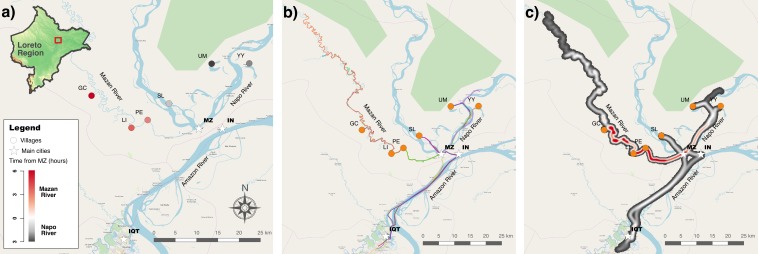
Figure 1. Study area in Mazan district, Loreto Region, Peruvian Amazon.
(A) Locale of Gamitanacocha (GC), Libertad (LI), Primero de Enero (PE), Salvador (SL), Lago Yurac Yacu (YY) and Urco Miraño (UM). (B) Polylines (or trajectories) collected with GeoODK, each color represents a participant. (C) Heatmap of transit based on trajectories. Maps were produced using QGIS, and the base maps was obtained from OpenStreetMap (http://www.openstreetmap.org) and OpenTopoMap (http://www.opentopomap.org), under CC BY-SA 3.0.

