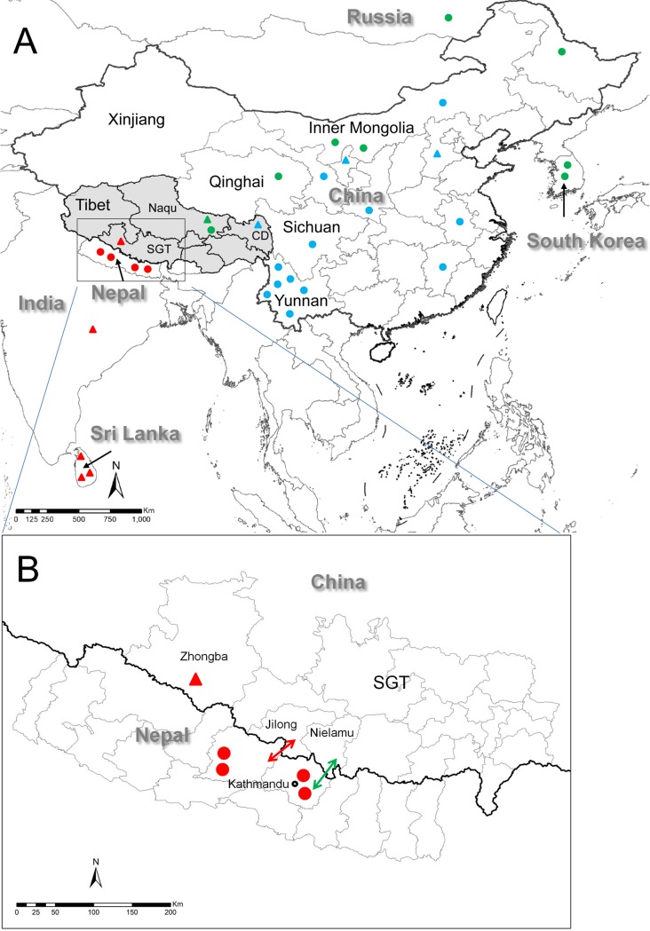
Fig 1.
Geographical location of recent human (2015, 2016 & 2017) and dog rabies cases (2012) in Tibet (A), and detailed map of the selected regions of China and Nepal (B). The cities of Tibet are abbreviated as follows: SGT, Shigatse; CD, Changdu. Human cases are shown as triangles, animal cases as circles. Blue triangles or circles indicate the strains of China I lineage in Fig 2; Green triangles or circles indicate the strains of China IV / Arctic-like-2 lineage in Fig 2; Red triangles or circles indicate the strains of China VII / Indian subcontinent in Fig 2. The red two-way arrow in Fig 1B marks the Jilong customs port between China and Nepal, and the green two-way arrow marks the Zhangmu customs port. The map is derived from a Topographic Database of the National Fundamental Geographic Information System (NFGIS) from the Chinese National Administration of Surveying, Mapping and Geoinformation (http://www.tianditu.com/).

