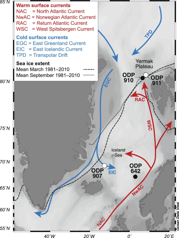
Figure 1.
Map of the Nordic Seas and marginal Arctic Ocean showing the modern oceanography and sea ice extent. ODP Site 907 (69°14.989′N, 12°41.894′W; ~1800 m water depth), ODP Hole 911A (80°28.466′N, 8°13.640′E; 902 m water depth) and other core locations discussed in the text (ODP holes 642B and 910C) are indicated. The mean minimum (=September, dotted line) and mean maximum (=March, dashed line) sea ice extent between 1981 and 2010 are shown (from http://nsidc.org/data/G02135)53. Map was generated with Ocean Data View54.

