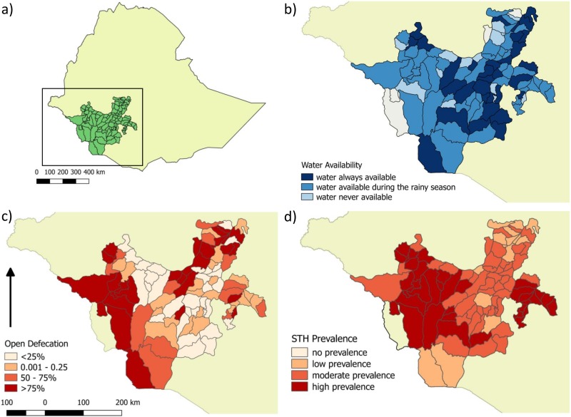
Fig 1. Maps depicting results from the regional survey in SNNPR.
(a) Location of SNNPR in Ethiopia; SNNPR is indicated in the box. (b) Reported water availability. (c) Incidence of open defecation as a proportion. (d) STH prevalence according to WHO risk categories (no prevalence, low prevalence 1% to 20%, moderate prevalence 20% to 50%, high risk ≥50%) [32]. Maps created by the authors on Quantum GIS Geographic Information System. Open Source Geospatial Foundation Project, using baselayers accessed on www.gadm.org June 2016. SNNPR, Southern Nations Nationalities and People’s Region; STH, soil-transmitted helminths; WHO, World Health Organization.

