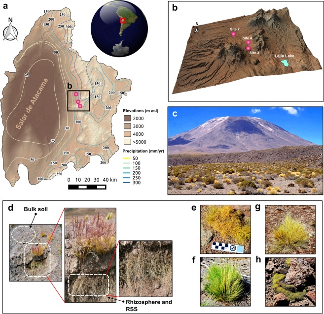
Figure 1.
Sampling site and plants investigated. Regional context of the study site in northern Chile showing (a) the location of the Salar de Atacama and adjacent Andes and (b) a digital elevation model indicating the sampling sites (colored dots). (c) Picture of the Andean steppe in the Chilean Altiplano, representative of sites 3, 4, and 7. (d) The three compartments sampled in this study. (e–h) The four plant species used in this study: Calamagrostis crispa, Nassella nardoides, Jarava frigida, and Pycnophyllum bryoides. The software used to create the map was QGIS 2.18 with STRM30106,107 elevation model (Data: SIO, NOAA, U.S. Navy, NGA, GEBCO) and Landsat 8 Satellite image by the Operation Land Imager (OLI) (Data available from the U.S. Geological Survey).

