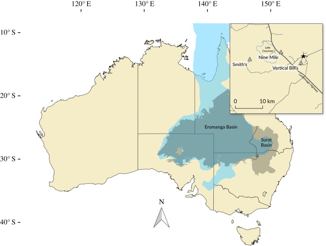
Figure 1.
Map of Australia showing the location of Lightning Ridge and the mineral claims in which the fossils were recovered. The extent of the Eromanga and Surat Basins is represented by the grey area separated by the dashed line. The maximum extent of the Eromanga Sea is indicated by the area in blue. Australia coastline uses data taken from GEODATA COAST 100 K 2004 provided by Geoscience Australia (http://www.ga.gov.au/metadatagateway/metadata/record/61395). Basin extents use data taken from [19].

