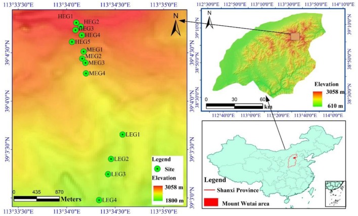
Figure 1.
Map showing the location of Mount Wutai and the sampling sites. High elevational gradient (HEG) (2900–3055 m) including five different elevation sampling sites (HEG1, HEG2, HEG3, HEG4, and HEG5), both medium elevational gradient (MEG) (2500–2800 m) (MEG1, MEG2, MEG3, and MEG4) and low elevational gradients (LEG) (2000–2300 m) (LEG1, LEG2, LEG3, and LEG4) including four different elevation sampling sites.

