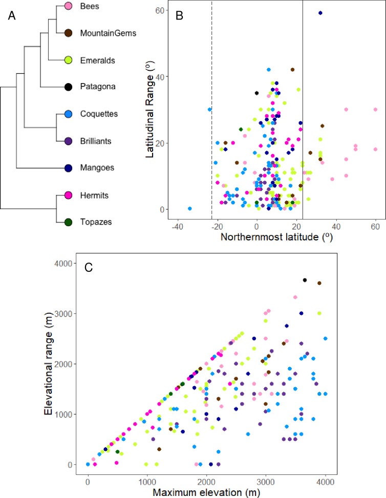
Fig 5. Hummingbird latitudinal and elevational ranges.
(A) Phylogenetic tree representing the hummingbird clades. The colors next to the clades match the colors in the plots, identifying the clade to which each species belongs. (B) Latitudinal range of hummingbird species (dots); the x-axis shows the northernmost latitude and the y-axis the mean latitudinal range. The vertical lines cross at the approximate latitude of the Tropic of Cancer (23° N, continuous line) and Tropic of Capricorn (23° S, dashed line) representing an approximate delimitation between the Nearctic, Neotropical and Austral biogeographical regions. For further details about biogeographical regions see text. (C) Elevational range of hummingbird species; the x-axis represents the maximum elevation and the y-axis the elevational range.

