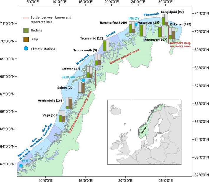
Figure 3.

Map of northern Norway showing the distribution of the 11 sampling areas from Vega (~65.5oN, 12.5oE) to the Russian border in the northeast (and also north to ~71oN, 27oE) with relative abundance of sea urchins (Strongylocentrotus droebachiensis, green columns) and kelps (Laminaria hyperborea and Saccharina latissima, brown columns) based on a total of 1,249 stations. Presence of kelp and sea urchins is not mutually exclusive, and the total percentage might therefore exceed 100% in some areas. The number of stations in each sampling area is shown in brackets. The three climatic stations (Bud, Skrova, and Ingøy) are shown as light blue dots. Counties are shown as blue and violet sections along the coast. The borders between the barren ground area and the northern and southern kelp recovery area are indicated by dark red lines
