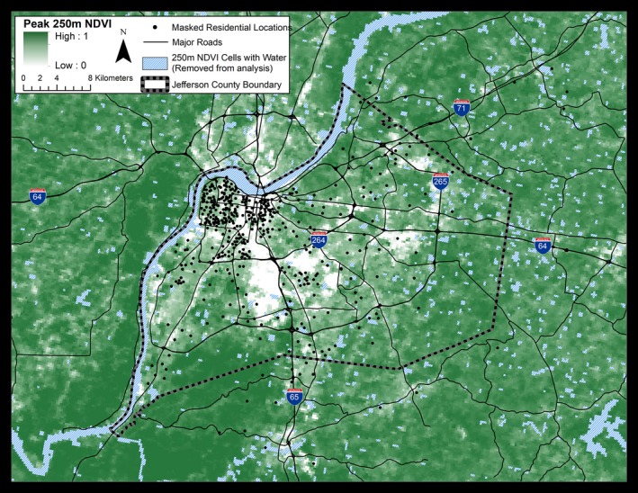
Figure 1.

Geographic location of study participants and the distribution of greenness within Jefferson County, Kentucky. Study participants (n=408) from indicated residential areas were recruited from a preventive cardiology clinic at the University of Louisville. Values of greenness, calculated as peak normalized difference vegetation index (NDVI), are shown at a resolution of 250 m. Attributes of land cover and greenness within the county vary between −0.1 and 1 NDVI unit. Low NDVI values are associated with business districts, industrial areas, and transportation zones. Residential areas show moderate NDVI, whereas urban parks, forests, and underdeveloped areas show high NDVI values. To protect participant privacy, exact residential locations are geographically masked and do not represent residential addresses.
