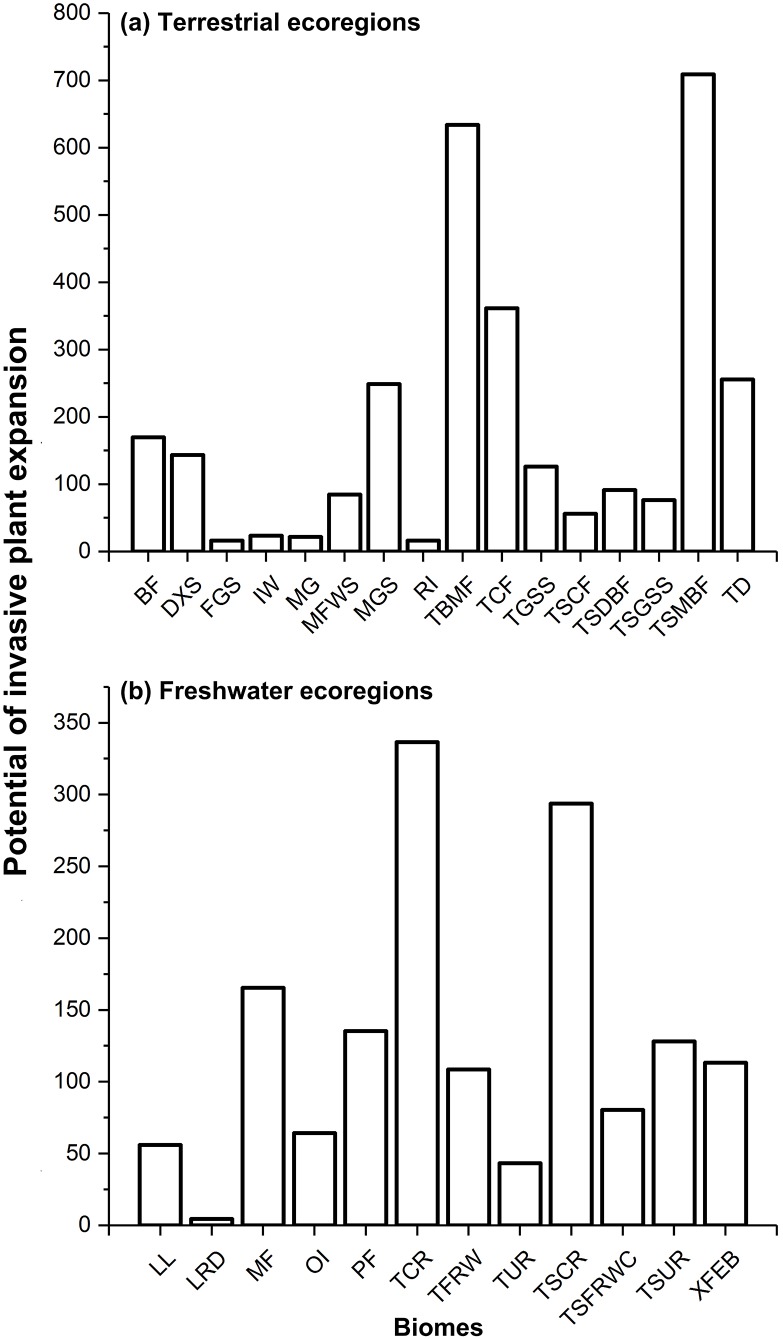
Figure 1. Potential of invasive plant expansion in terrestrial (A) and freshwater (B) ecoregions in RCP 4.5.
The numbers of this figure represent the degrees of invasive plant expansion potential based on the sum values on change of climatic suitability of pixels for multi-IPS between current conditions and the 2080s (RCPs 4.5 and 8.5) at ecoregional levels. Terrestrial represents terrestrial ecoregions; Freshwater represents freshwater ecoregions; Codes used in this figure are defined as follows: For terrestrial ecoregions: BF, boreal forests/taiga; DXS, deserts and xeric shrublands; FGS, flooded grasslands and savannas; IW, inland water; MG, mangroves; MFWS, Mediterranean forests, woodlands and scrub; MGS, montane grasslands and shrublands; RI, rock and ice; TBMF, temperate broadleaf and mixed forests; TCF, temperate conifer forests; TGSS, temperate grasslands, savannas and shrublands; TSCF, tropical and subtropical coniferous forests; TSDBF, tropical and subtropical dry broadleaf forests; TSGSS, tropical and subtropical grasslands, savannas and shrublands; TSMBF, tropical and subtropical moist broadleaf forests; TD, tundra. For freshwater ecoregions: LL, large lakes; LRD, large river deltas; MF, montane freshwaters; OI, oceanic islands; PF, polar freshwaters; TCR, temperate coastal rivers; TFRW, temperate floodplain rivers and wetlands; TUR, temperate upland rivers; TSCR, tropical and subtropical coastal rivers; TSFRWC, tropical and subtropical floodplain rivers and wetland complexes; TSUR, tropical and subtropical upland rivers; XFEB, xeric freshwaters and endorheic (closed) basins.

