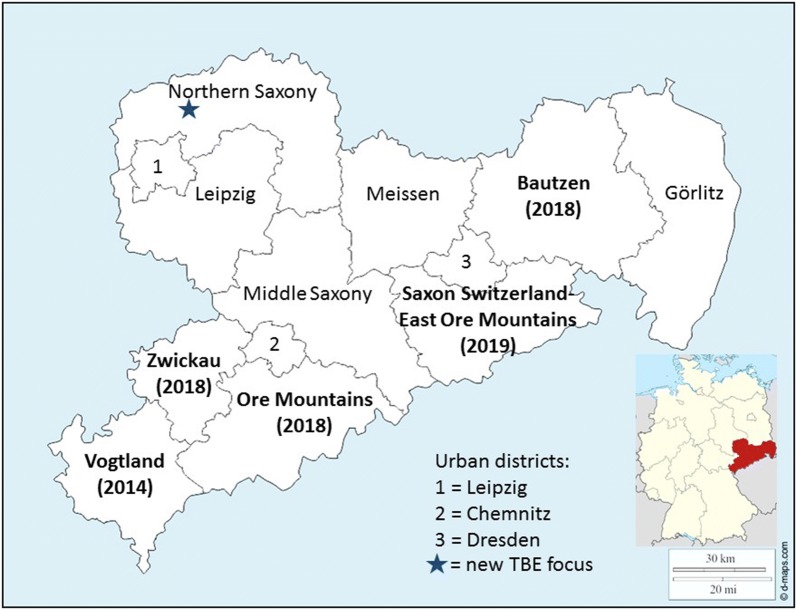
Fig. 1.
A map of Saxony showing all counties. Names of counties considered as TBE risk area according to the federal Robert Koch Institute are named with bold lettering showing the year since they were considered TBE risk area in parentheses. The new TBE focus described here is indicated by an asterisk. At the time of our study it was about 150 km north of the next known risk area

