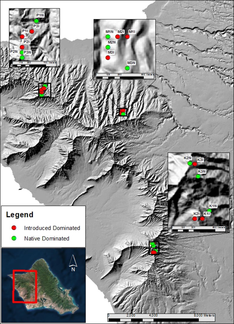
Fig. 1.
Map of Oahu island in Hawaii with sampling locations of 18 plots in three watersheds (K, Palikea; M, Manuwai; P, Pahole) dominated by native (green circles) and invasive (red circles) vegetation. Each plot was 24 m × 24 m. Within watershed, plots were separated by a minimum of 70 m, with a maximum separation of 780 m

