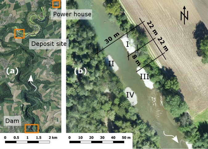
Figure 1.
(a) Replenishment site and the locations of the dam and power house, background Geodata © swisstopo. (b) Configuration of the four sediment deposits in the Sarine River, background © Research unit Ecohydrology, ZHAW. The distance between the deposits was about a deposit length, the shift between the deposits on the left and the right bank is half a deposit length. The height of the deposits was ca. 1.5 m above the initial river-bed. The numbering refers to the name of the deposits from upstream to downstream: deposit I, II, III and IV.

