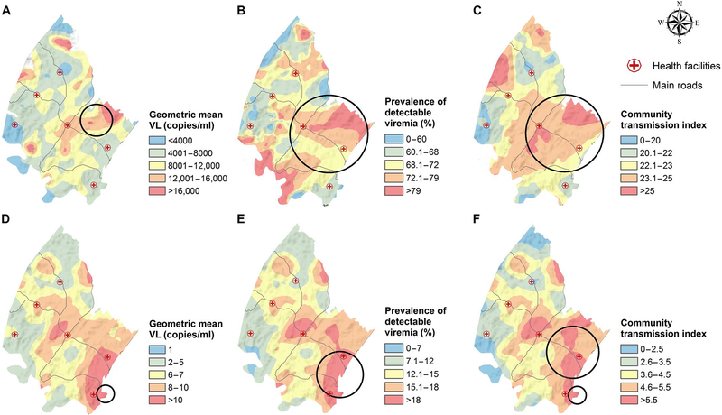
Fig. 2. Geographical variations in the population viral load (PVL) indices derived from the 2011 population-based viral load survey.
The PVL indices are derived from HIV-positive participants only (A to C) and both HIV-positive and HIV-negative participants (D to F). The PVL maps were obtained using a moving two-dimensional standard Gaussian kernel of a 3-km radius. The Kulldorff spatial clusters of high viral loads are shown as black circles. Further details of the Kulldorff spatial clustering results are given in table S9. VL, viral load.

