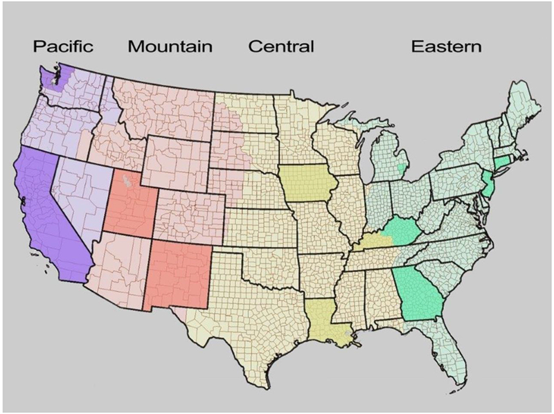
Figure 2.

Map of the Continental United States showing the 4 timezones (Pacific- purple, Mountain- peach, Central- yellow, Eastern-green) with each of the 11 SEER states (California, Connecticut, Georgia, Iowa, Kentucky, Louisiana, New Mexico, New Jersey, Utah) and registries (the Detroit metropolitan area of Michigan and the Seattle-Puget Sound area of Washington) shaded a darker shade. The 607 counties are also indicated.
