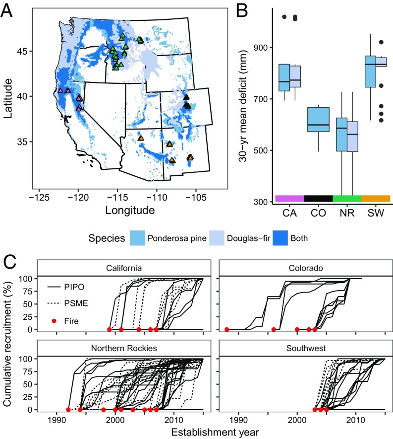
Fig. 2.
Map of study site locations in the western United States (A), 30-y (1981–2010) mean climatic water deficit for sample sites within each region (B), and cumulative recruitment following fires for each site (C). Overall, 90 sites were sampled (see SI Appendix, Tables S1 and S2 for details). Ponderosa pine (PIPO) and Douglas-fir (PSME) ranges are shown in blue in A (72).

