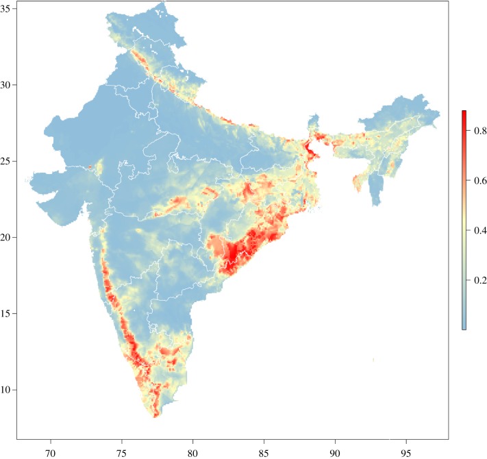
Figure 4.
Predicted geographical anthrax suitability across India based on the best-fitting and best-performing Maxent model (Model 6). Boundaries reflect individual states. The colour spectrum of anthrax suitability runs from blue (low suitability) to red (high suitability). All maps are displayed only for the purposes of depicting the distribution of disease occurrence and risk, and do not reflect the authors’ assertion of territory or borders of any sovereign country including India. Map direction and scale are represented by the latitude and longitude grid along the box. All maps are created in R (v. 3.3.1).

