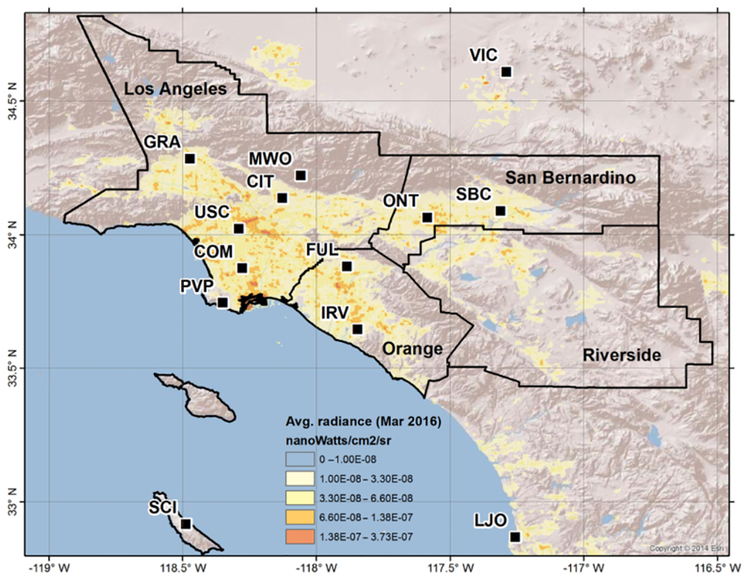
Figure 1.
Map of the Los Angeles megacity and locations of the greenhouse gas monitoring network sites. Site locations are shown by the black squares (see Table 1 for details). The South Coast Air Basin (perimeter of the black line) is a geopolitical boundary including non-desert portions of the Los Angeles, Riverside, and San Bernardino counties, as well as all of Orange County (defined by the interior back lines). Background image shows surrounding topography plotted with the average monthly nightlight radiance data from VIIRS during March 2016 (units nW cm−2 sr−1) as a proxy for population density. Continuous measurements from the MWO, SBC, PVP, and CIT sites are not included as part of this study; however, MWO flask data are included as part of the background analysis (Fig. 4).

