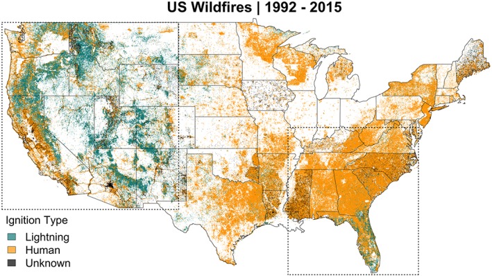
Figure 2.

Location and ignition type of all wildfires documented in the Fire Program Analysis Fire Occurrence Data located within the contiguous United States between 1992 and 2015. There are 1,880,465 wildfires in the record, 15% ignited by lightning, 77.7% by humans, and 7.3% fires with an unknown/missing ignition type. The plotted wildfires account for 107,508,006 acres of area burned over the period. The dashed‐line box over the western United States shows the geographic extent of the “western United States” (i.e., “west”) region. The dashed‐line box over the southeast United States shows the region defined as “southeast United States” (i.e., “southeast”) in this study.
