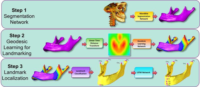
Fig. 3:

Following the Mandible Segmentation with Fully Convolutional DenseNet, Linear Time Distance Transform (LTDT) of the Mandible Bone is generated. A second U-Net [8] is used to transform LTDTs into a combined Geodesic Map of the mandibular landmarks Menton (Me), Condylar Left (CdL), Condylar Right (CdR), Coronoid Left (CdL), and Coronoid Right (CdR). Finally, an LSTM Network is used to detect Infradentale (Id), B point (B), Pogonion (Pg), and Gnathion (Gn) mandibular landmarks according to the detected position of the Menton (Me) in previous step. All algorithms in this proposed pipeline run in pseudo-3D (slice-by-slice 2D). To ease understanding of the segmentation results, surface rendered volumes are presented instead of contour based binary images.
