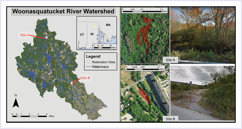
Figure 4.
Example restoration sites in the Woonasquatucket River Watershed. (Left) Map showing the watershed and locations of the 2 sites; (Top) aerial photo with site A in orange and a Google street view image of the area adjacent to the nearest road; (Bottom) aerial photo with site B in orange and a Google street view image showing the site and apartment building across the river. The Woonasquatucket River is shown in blue in the aerial photos.

