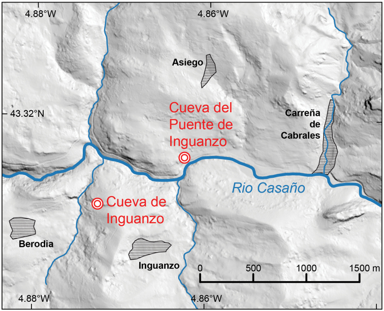
Figure 15.
Map indicating geographic position of the two different Inguanzo-named caves on either side of the Rio Casaño: Cueva del Puente de Inguanzo (collection site of Gittenberger’s (1980) shells) and Cueva de Inguanzo (site of Weigand et al. (2013) molecularly-assessed material). Source of DEM data: LiDAR-PNOA DGM 5 m owned by Instituto Geográfico Nacional (IGN) and provided under CC-BY 4.0 license.

