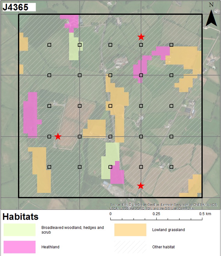
Fig 1. An NPMS survey square.
An example of an NPMS one kilometre square (monad) showing the locations of randomly selected plot locations in relation to semi-natural habitats. These are positioned at the intersections of a fixed grid, with the exception of those plots that would intersect urban areas. The possible locations of three accessible linear plots along margins of arable fields or hedgerows are indicated with red stars. Base map attribution: Esri, DigitalGlobe, GeoEye, Earthstar Geographics, CNES/Airbus DS, USDA, USGS, AerGRID, IGN and the GIS User Community.

