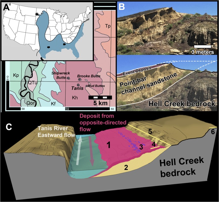
Fig. 1.
Map of the Tanis study locality. (A) Tanis within a regional context (large map) and on a national map (Inset). Reprinted with permission from ref. 14; black dots in Inset are previously documented KPg tsunami localities; star denotes Tanis. Kf, Fox Hills Formation; Kh, Hell Creek Formation; Kp, Pierre Shale; Qor, Holocene; QTu, Quaternary and Upper Tertiary; Tp, Slope Formation. (B) Photo and interpretive overlay of an oblique cross-section through Tanis, showing the contact between the angled point-bar sandstone and the gray Hell Creek bedrock. (C) Simplified schematic depicting the general contemporaneous depositional setting for the Event Deposit (not to scale). The Event Deposit (1) covers the slope of a prograding point bar of a meander (2), which incised into the Hell Creek bedrock during the late Cretaceous. Location of the densest carcass accumulations (3) along the slope; location of KPg boundary tonstein directly overlying the Event Deposit (4); location of KPg tonstein overlying the adjacent overbank (5); location of Brooke Butte (6), the closest KPg outcrop to Tanis.

