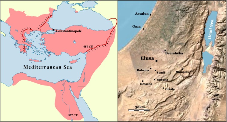
Fig. 1.
(Left) Map of the Byzantine Empire at the beginning of the reign of Justinian in the year 527 CE (area in red), shortly before the territorial gains following from the Justinianic wars in Asia, Africa, and Europe. Black arrows represent the devastating territorial contraction of the Byzantine Empire in the wake of the Sasanian Wars and early Islamic conquests of the seventh century. (Right) Location map of the city of Elusa and Byzantine period village network of the Negev. Base map generated from intellectual property of Esri and its licensors and are used under license. Copyright © 2009–2019 Esri and its licensors. All rights reserved.

