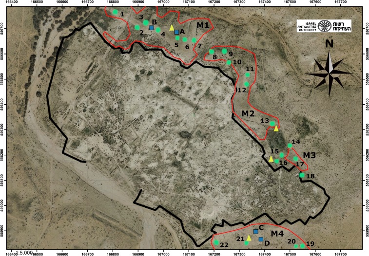
Fig. 2.
Survey, probing and excavation locations in Mounds M1 to M4 shown on an aerial photo of Elusa: circles 1–22, survey quadrants; triangles, dating probes; squares A–D, excavation trenches. Mound polygons in red identified from our DEM and the reconstructed outline of the ancient settlement taken from Saidel and Christopherson (23) (Fig. 5).

