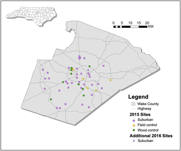
Fig 1. Trapping sites within Wake County, North Carolina.
All 2015 sites denoted by a circle were also sampled in 2016, with the addition of 6 older suburban sites that were sampled exclusively in 2016, denoted by a triangle. Map created using public domain data from Wake County Government’s Wake County GIS [28] and the U.S. Census Bureau’s 2017 TIGER/Line Shapefiles [29].

