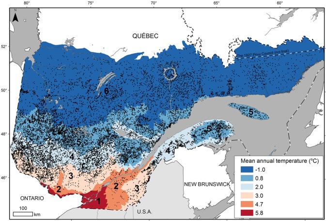
Figure 1.
Location of sample plots (black dots n = 33,711) in Quebec (Canada) where black spruce trees were sampled for tree-ring measurements. The numbers correspond to bioclimatic domains which were mainly associated with variations in mean annual temperature along the latitudinal gradient of the studied territory. 1: sugar maple-bitternut hickory domain; 2: sugar maple-basswood domain; 3: sugar maple-yellow birch domain; 4: balsam fir-yellow birch domain; 5: balsam fir-white birch domain; 6: spruce-moss domain. Map created using ArcGIS (version10.3) software from Esri inc. (http://www.esri.com/arcgis/). Data for base maps from https://www.donneesquebec.ca/recherche/fr/dataset/systeme-hierarchique-de-classification-ecologique-du-territoire and https://www.donneesquebec.ca/recherche/fr/dataset/base-de-donnees-geographiques-et-administratives-a-lechelle-de-1-1-000-000 used with permission under a Creative Commons 4.0—Attribution CC BY.

