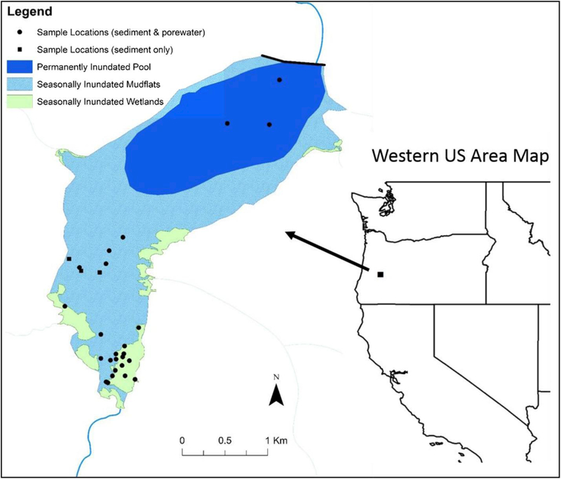
Fig. 1.

Map showing the sample locations in Cottage Grove Reservoir. Note: the Black Butte mine is located 15 km upstream of the reservoir and is outside the scale of this areas kept low during much of the year that experiences higher rainfall (September through April). During the low pool conditions, over 60% of the reservoir area is exposed sediment, which are seasonally inundated during the summer months. When the water levels are raised to full-pool conditions, vegetated wetland areas that occur mostly near the inlet are inundated with reservoir water. The wetlands are fairly extensive (∼36 ha) and cover approximately 8% of the total surface area of the reservoir.
