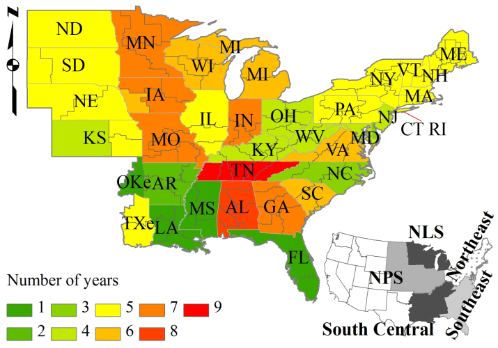
Figure 1. The locations of FIA survey units in the eastern United States with background color indicating the numbers of years from 2002 to 2010 that recorded the annualized data for tree removal.
An FIA survey unit was defined as a group of counties in a state. NPS: Northern Prairie States; NLS: Northern Lake States; OKe: eastern Oklahoma; TXe: eastern Texas. Maps were generated using ArcGIS 9.3 (www.esri.com/software/arcgis).

