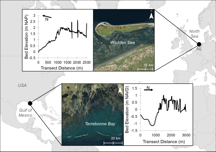
Fig 1. General location of sites selected to illustrate contrasting coastal wetlands: A prograding system with plentiful sediment supply (Friesland, Wadden Sea, the Netherlands) and a degrading system with limited sediment supply (Mississippi Delta, LA, USA).
Arrow refers to North direction. Created with ESRI ArcGIS 10.6.1 software. Basemap satellite images accessed from World Imagery ESRI Tile Layer located in: https://services.arcgisonline.com/ArcGIS/rest/services/World_Imagery/MapServer (credits: Esri, DigitalGlobe, GeoEye, Earthstar Geographics, CNES/Airbus DS, USDA, USGS, AeroGRID, IGN, and the GIS User Community). Background basemap accessed from World Countries (Generalized) ESRI Feature Layer located in https://services.arcgis.com/P3ePLMYs2RVChkJx/arcgis/rest/services/World_Countries_(Generalized)/FeatureServer (credits: Esri, DeLorme Publishing Company, Inc.).

