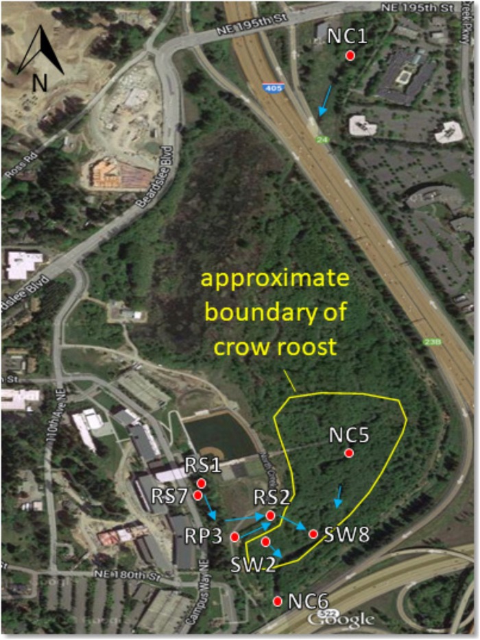
FIGURE 1.
Sampling site map showing North Creek, the UW Bothell/Cascadia College campus, and the 58 acre restored floodplain wetland. Red dots indicate locations of surface water sampling sites. Blue arrows indicate direction of water flow. Water sampled at RS1, RS7, and RP3 flows to these locations in a series of catch basins and pipes from the upland (western) portion of the campus. The crow roost boundary fluctuates year to year, though the southern part by the sampling sites is relatively stable. Aerial photograph from Google.

