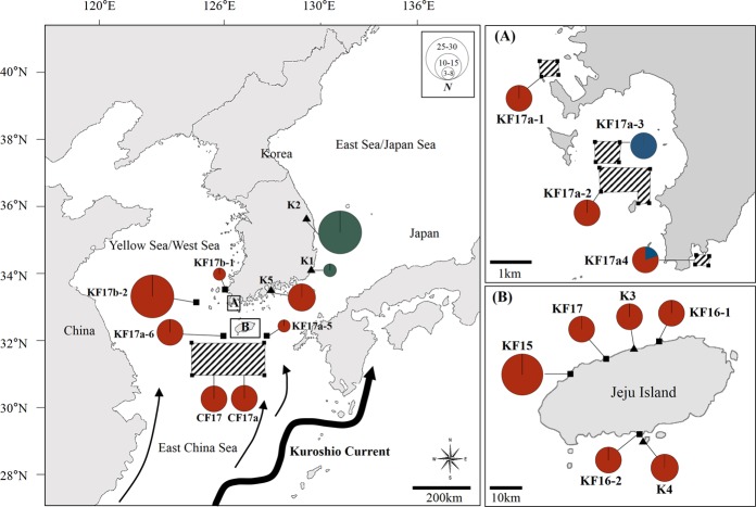
Figure 2.
Map of sampling sites for floating and benthic populations of Sargassum horneri from the South Sea, the West Sea, the East Sea and Jeju Island along the Korean coast and also from the East China Sea (ECS), approximately 250 km off the Korean Peninsula. Floating populations (shown by small black-filled squares) were sampled from 13 different localities (the ECS population was sampled twice at different time periods in 2017) and benthic populations (small black-filled triangles) were sampled from five localities. The sampling sites of the ECS (CF17 and CF17a) and Haenam (HN; KF17a-1–4) are shown as marked areas with oblique lines connecting the points. (A) Haenam (HN; KF17a-1–4) from the South Sea. (B) Jeju Island, off the southernmost region of the mainland. This map also shows the geographical distributions of mtDNA cox3 haplotypes of S. horneri that we determined. The area of the circle is proportional to individual numbers found for the respective haplotype and different colours denote different haplotypes (red: Hap 1, green: Hap 2, blue: Hap 3). Black arrow lines represent directions of the Kuroshio Current around Korean waters. Detailed information of each sampling locality is given in Table 1. Population abbreviations as in Table 1.

