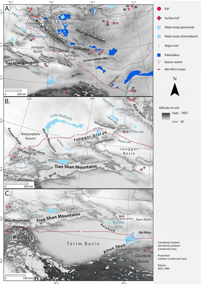
Fig 4.
(A) Map of geographic features that guide or border the ‘Altai’ Route. (B) Map of geographic features that guide or border the ‘Tian Shan’ Route. The eastern part of the route after the Junggar Basin connects with the ‘Altai’ Route. (C) Map of geographic features that guide or border the ‘Tarim’ Route. The eastern part of the route after the Bei Mountains connects with the two other routes. Sites: 4. Obi-Rakhmat, 5. Shugnou, 8. Denisova, 9. Ust-Karakol, 10. Kara-Tenesh, 11. Kara-Bom, 12. Luotuoshi, 14. Gouxi, 15. Lenghu 1, 17. Chikhen Agui, 18. Tsagaan Agui, 19. Tolbor 4, 20. Kharganyn Gol 5, 21. Orkhon 1 & 7, 22. Makarovo 4, 23. Kandabaevo, 24. Varvarina Gora, 25. Tolbaga, 27. Shuidonggou 1, 28. Shuidonggou 9. Base map is HYDRO1K.

