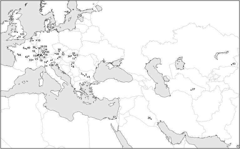
FIGURE 4.
A map containing data points for select finds of archaeobotanical remains of apple seeds recovered from archeological sites dating between the eighth and first millennia B.C. Sites dating to later time periods are assumed to contain remains of cultivated apples, which are likely to have been dispersed beyond their early Holocene distribution. Most of the data points presented in the map cluster over known Pleistocene glacial refugia, illustrating the limited range and areas of density in wild Malus during the early and mid-Holocene. The site names, ages, and references are presented in Supplementary Material.

