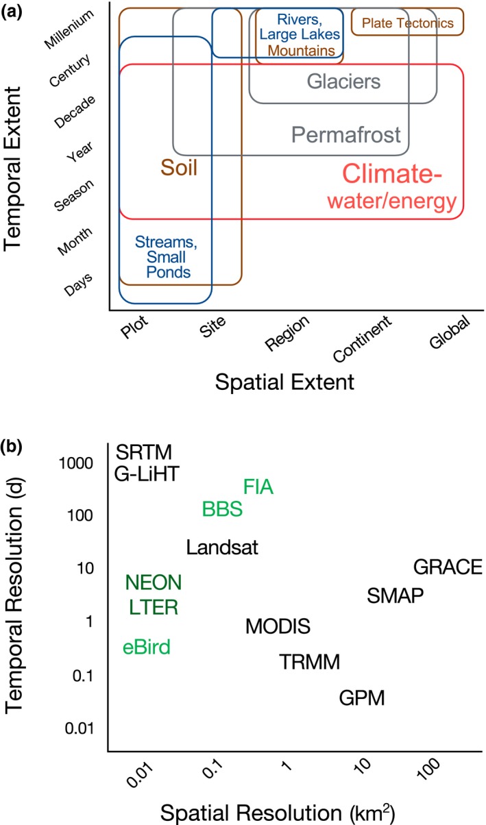
Figure 1.

Geodiversity across scales. (a) Examples of geodiversity variables and the spatial and temporal extents at which they vary. Geodiversity encompasses abiotic components of the Earth's critical zone, specifically the lithosphere (brown), atmosphere (red), hydrosphere (blue) and cryosphere (grey) (Natural Resources Council, 2001; Parks & Mulligan, 2010). In general, surficial geodiversity at regional to global scales remains constant over short time‐frames (e.g., days to years), whereas local‐scale surficial geodiversity (e.g., micro‐topography and the physical and chemical properties of soil) vary over short to intermediate time‐frames (e.g., years to centuries). (b) Examples of satellite remotely sensed geodiversity (black). As point data, biodiversity data (green) are often high resolution, but are lacking in spatial and temporal extent. Networked sites, such as the National Ecological Observatory Network (NEON) and Long‐Term Ecological Research (LTER) sites, provide a combination of biodiversity and geodiversity (dark green). See an interactive table with a more complete list of NASA missions and products for geodiversity at: https://bioxgeo.github.io/bioXgeo_ProductsTable/, also in Suporting Information Appendix A. Additional abbreviations are as follows: BBS = Breeding Bird Survey; FIA = forest inventory and analysis; G‐LiHT = Goddard's LiDAR hyperspectral thermal imager; GPM = global precipitation measurement mission; GRACE = gravity recovery and climate experiment; MODIS = MODerate resolution imaging spectroradiometer; SMAP = soil moisture active passive; SRTM = shuttle radar topography mission; TRMM = tropical rainfall measuring mission [Colour figure can be viewed at wileyonlinelibrary.com]
