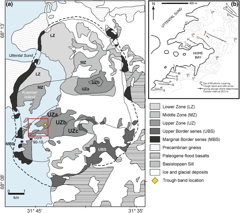
Fig. 1.
a Simplified geological map [after McBirney (1989)] of the Skaergaard intrusion, showing the position of the trough layering examined here, together with the location of drill core 90–10. The red box shows the area enlarged in b. b Map showing the location and trend of the trough axes [from Wager and Deer (1939)]

