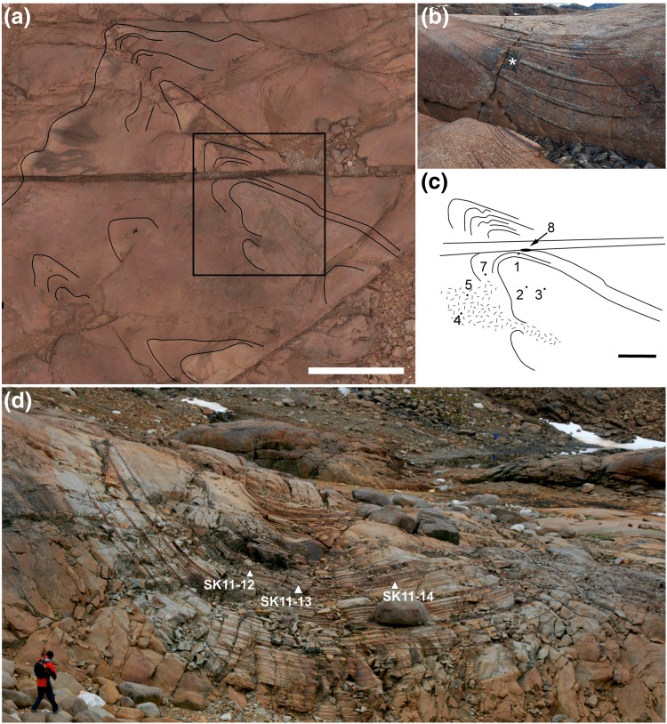
Fig. 5.
a Aerial view of Trough F, with North pointing upwards, taken using a drone-mounted camera. The scale bar is 20 m long. The field of view is cut by a prominent gully running E/W: this is the trace of an eroded camptonite dyke. Well-defined modal layers are outlined by the black lines, and show a poorly defined subsidiary trough to the SW of Trough F. The area outlined by the black box is shown enlarged and in schematic form in c. b The southern wall of the eroded camptonite dyke was sampled to collect a large specimen (F8) of the modal layering (marked with an asterisk). c A sketch map of the area outlined in a, showing schematic modal layering and the position of short drill holes collected in 1966 (F1–F7, although F6 lies out of the field of view, immediately to the west). F8 is the large specimen, with the site of collection shown in b. All samples are housed in the Sedgwick Museum of the University of Cambridge. d Trough G, viewed looking towards the intrusion centre, showing the location of the samples examined for the present study

