
Fig. 1.
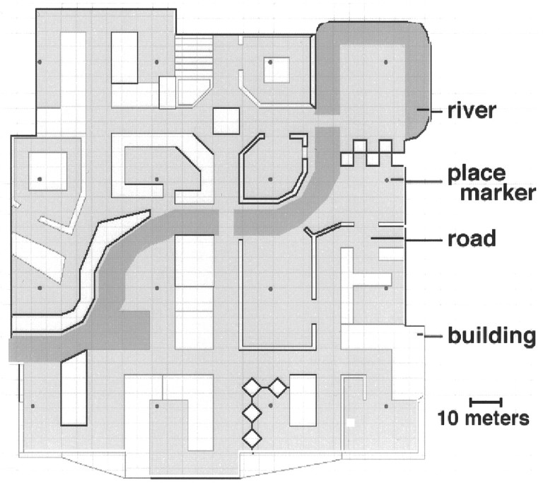
Aerial view of the virtual reality town. The town contained 16 distinctive, named “places” interconnected by a variety of roads and paths and arranged in a 4 × 4 grid. A river divided the town approximately in half. Subjectively, the town was ∼140 meters in width. Each place was designated as such by the presence of a small round marker in the ground.