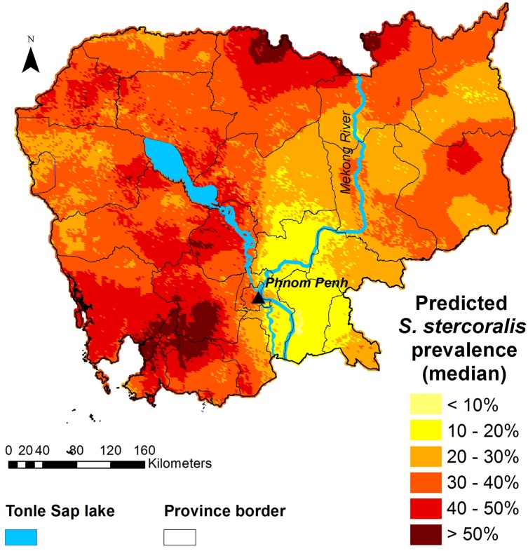
Fig 5. Map of the predicted prevalence (median) of S. stercoralis in Cambodia.
Predictions were obtained with the geostatistical model shown in Table 3, based on survey data collected in 2016 from 7,246 participants aged 6 years and older, living in 249 villages across Cambodia. This map was created with ArcGIS version 10.0 (ESRI; Redlands, CA, USA) and display the results obtained specifically from this study by Forrer et al.

