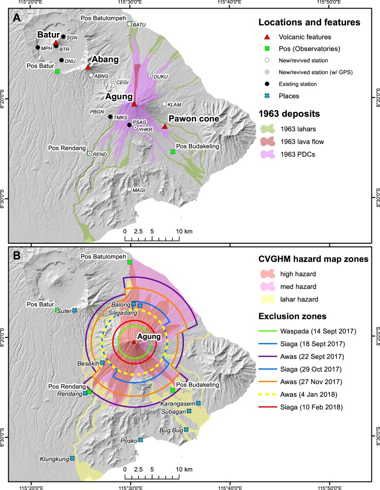
Figure 1.
Maps of Agung. (A) Location map of the area surrounding Mount Agung, in eastern Bali. Volcanic features (red triangles), locations of the observatories (pos, green squares), and relevant towns (blue crosses) are overlain on a Shuttle Radar Topography Mission (SRTM) 30 m DEM. The 1963 lava flow, pyroclastic density current, and lahar deposits are modified from2. (B) CVGHM hazard zones from the published hazard map39 are shown along with the exclusion zones established through the crisis. Note that the 18 September and 29 October exclusion zones (in blue) are the same.

