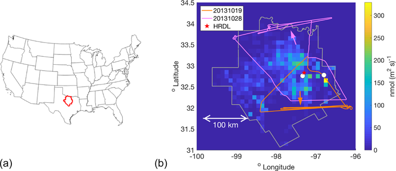
Figure 1.

(a) Location of the 25-county Barnett Shale domain (red) within the US. (b) The 25-county domain covered by the Z–A inventory (gray outline), colored by the magnitude of the inventory CH4 fluxes (shown at the 0.1° resolution used here). Two sample flight tracks are indicated, from 20131019 and 20131028, with arrows of the same color indicating the average wind direction on each day. The cities of Fort Worth and Dallas are indicated by white circles. The red star near Fort Worth indicates the location of the high-resolution Doppler lidar (HRDL), whose measurements were used to evaluate the WRF model wind speed and PBL depth.
