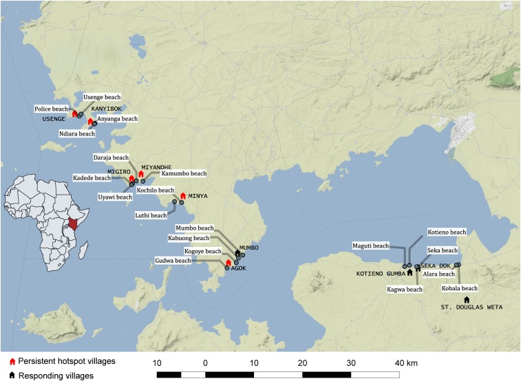
Figure 1.
Map showing position of study villages along the shore of Lake Victoria, Kenya. The map was constructed using the QGIS version 2.18.22 and 3.2.1; the base map layer was added from the standard terrain tiles provided from http://maps.stamen.com through the OpenLayers function. The tiles are © Stamen Design (San Francisco, CA), under a creative commons attribution (CC BY 3.0) license. The data for the locations were obtained manually using cellular phone global positioning system (GPS) functionality according to the WGS1984 mercator projection. This figure appears in color at www.ajtmh.org.

