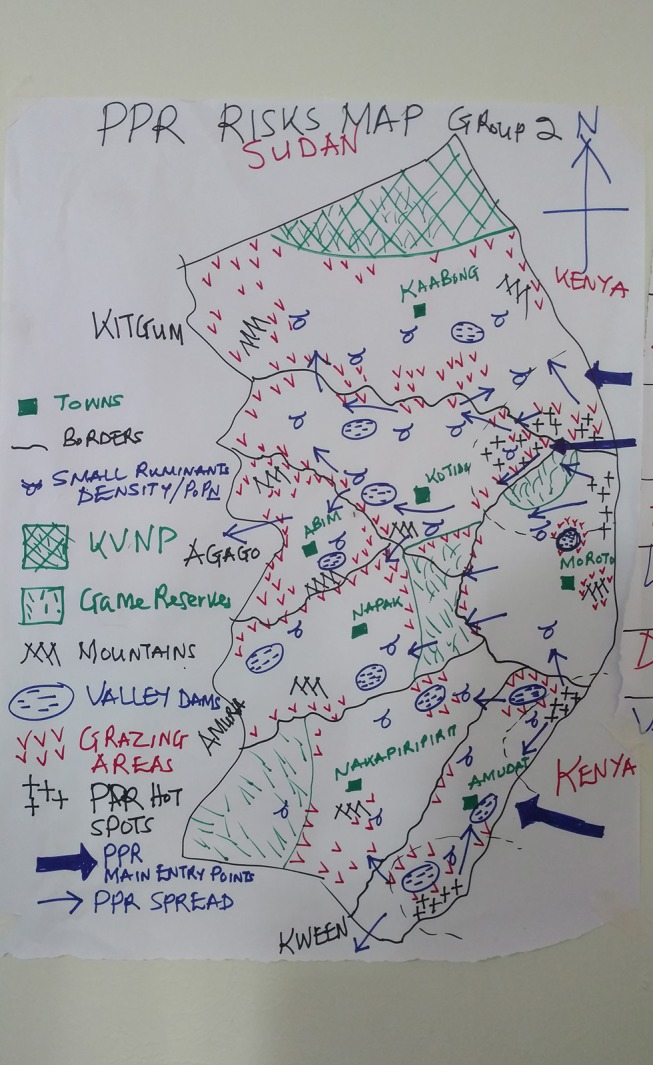
Figure 2.

Example of a Karamoja Risk Map. Example of a risk map drawn by a focus group of veterinarians, community animal health workers and kraal leaders from across Karamoja. The thick blue arrows indicate the perceived main entry points for PPR to Karamoja and the thin blue arrows represent spread across Karamoja. Black crosses are PPR transmission hotspots. The northern focus includes Nakapelimoru subcounty of Kotido, Loyoro subcounty of Kaabong District. The southern focus is centered on Loroo sub county of Amudat. A third focus is indicated in the extreme south in Karita sub county of Amudat was not included in the project for financial reasons.
