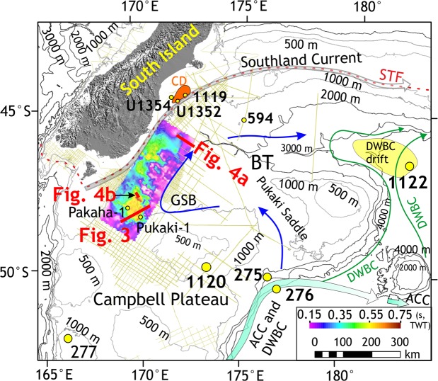
Figure 2.
Study area map. Map showing the South Island of New Zealand, Campbell Plateau, sub-Tropical Front (STF)72, Antarctic Circumpolar Current (ACC), Pacific Deep Western Boundary Current (DWBC)73,74 and a modern cyclonic circulation (marked by blue arrows) in the Great South Basin (GSB) and the Bounty Trough (BT). Canterbury drifts (CD)59 and DWBC drifts28 are shown. Time thickness (two-way travel time in seconds) map of the mid-Eocene to Late Eocene interval in the GSB shows the NNE–SSW striking elongate sedimentary drift. Subsidiary drifts were deposited on the eastern offshore side of the main mound. Boreholes of ODP Leg 181 (1119, 1120 and 1122), IODP expedition 317 (U1352 and U1354), DSDP Leg 29 (275 and 276), Leg 90 (594) and oil exploration wells (Pukaki-1 and Pakaha-1) are marked.

