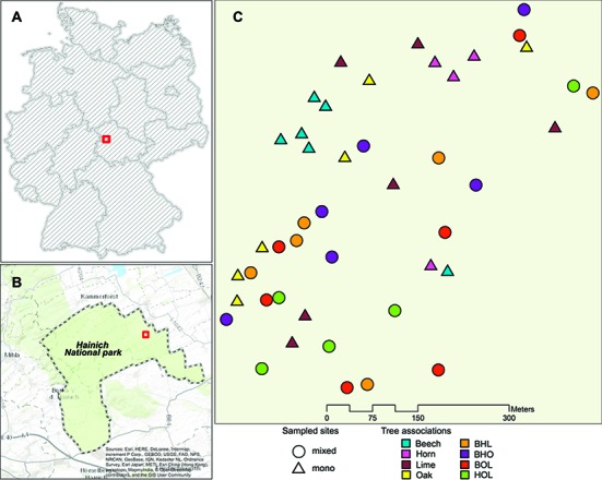
Figure 1.

Area of study in the Hainich national park. (A) Boundary of the Hainich national park (51°05′37.0 N, 10°30′10.6 E). (B) Map of Germany showing location of the Hainich National Park in Thuringia, Germany. (C) Sampling area showing distribution of mono stands and mixed stands used for sample collection. Abbreviations stand for the following tree species associations in mixed stands: beech-hornbeam-lime (BHL), beech-oak-hornbeam (BHO), beech-oak-lime (BOL), and hornbeam-oak-lime (HOL). The map was generated by using data from the following data providers: Esri, HERE, DeLorme, Intermap, increment P. Corp., GEBCO, USGS, FAO, NPS, NRCAN, GeoBase, IGN, Kadaster, NL, Ordnance Survey, Esri Japan, METI, Esri China (Hong Kong), swisstopo, Mapmyindia, @OpenStreatMap contributors, and the GIS user community.
