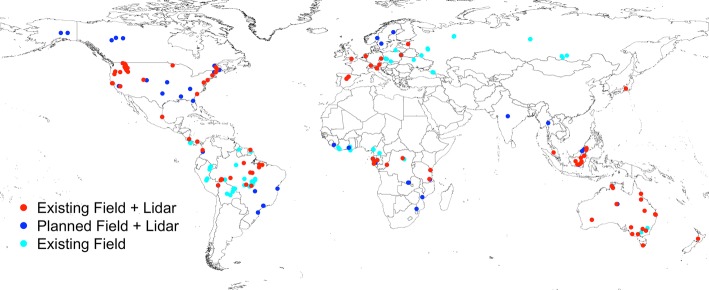
Fig. 1.
Existing or planned field and airborne lidar datasets for use in spaceborne mission biomass model fitting or product validation. The red points have been compiled by the NASA GEDI team and are used in their biomass model development. The blue points, compiled by the NISAR team, are planned sites for both model development and product validation. The turquoise sites, compiled by the Forest Observation System (FOS, Chave et al. 2019), represent high-quality standardized field estimates of biomass

