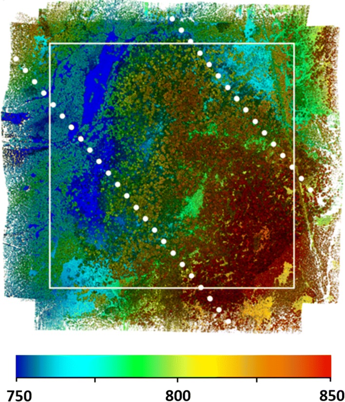
Fig. 2.

Operational drone lidar in support of mission science. We collected these data using the Brown Platform for Autonomous Remote Sensing in a temperate beech forest in the southern Czech Republic in April, 2018. Colors indicate elevation (m), and the tallest trees are about 40 m. The white box is 1 by 1 km and equal in size to the GEDI L4B aboveground biomass density data product. White dots are simulated GEDI L4A ground tracks, drawn to scale (22 m footprint diameter, 60 m along-track spacing, 600 m across-track spacing, track inclination is arbitrary). These data were collected in five flight hours using 90 flight lines at 90° angles. Mean point density is 2801 points · m−2. Collecting lidar data at 100 points · m−2 takes about 6 min · km−2 using this platform
