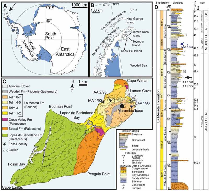
Figure 1.

Location and stratigraphy of Seymour Island, Antarctica (A) map of Antarctica, showing the position of the Antarctic Peninsula; (B) map of the Antarctic Peninsula, showing the location of Seymour Island; (C) Geological map of Seymour Island, showing the outcrop of TELMs 5–6 with the localities IAA 1/90, IAA 2/95 and IAA 1/93 of the Eocene La Meseta Formation; (D) composite measured section trough the La Meseta and Submeseta formations, showing the stratigraphical position of the sampled localities IAA 1/90, IAA 2/95 and IAA 1/93. [175 × 160 mm, planned for whole page width].
Notes: Modified from Schwarzhans et al. (2016).
